-
Weather
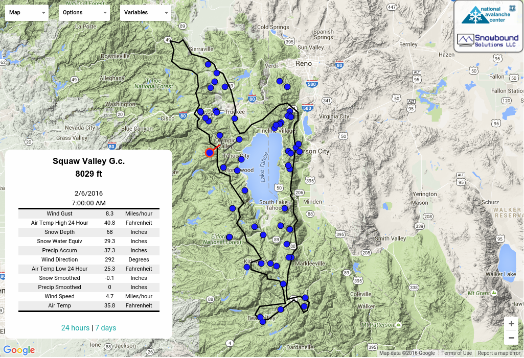
Remote Weather Stations
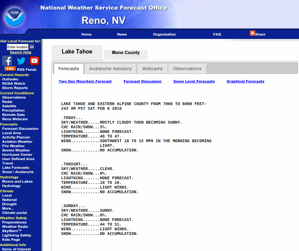
National Weather Service
Instability on Silver Peak
|
Location Name: Silver Peak Region: Cabin Creek, Deep Creek, or Pole Creek Area Date and time of observation: Wed, 03/06/2013 - 12:00 |
|
|---|---|
|
Location Map: United States
39° 13' 24.852" N, 120° 14' 35.448" W
See map: Google Maps
US
|
Red Flags: Recent avalanche activity Whumphing noises, shooting cracks, or collapsing Recent loading by new snow, wind, or rain Obvious avalanche path |
Observation made by: Forecaster